
Project Details
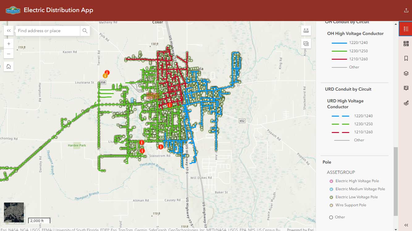
The City of Wauchula is a small central Florida rural community of about 5000 residents, along the narrow US 17 route between Lakeland and Port Charlotte/Fort Myers. As small as they are, they maintain their own utilities, including water, wastewater, and electric. Once relying on ad-hoc GIS support from Hardee County they wanted to expand their utilities support with a more robust GIS, utilizing the latest in ESRI ArcGIS technologies. To get them started on this path, GISaaS migrated and consolidated their electric utilities GIS into the latest ESRI Solution, implementing the “Electric Utility Network Foundation” data model. Our efforts include managing user licensing and mapping access in the city’s ArcGIS Online portal, connecting GIS resources to desktop ArcPro and implementing and training field operations on Asset markup using iPad tablets and ESRI’s Field Mapping application.
To help them focus on their utilities, GISaaS serves as the city’s GIS department, managing GIS layers, maps, and applications that serve the city’s administration and operations and help them manage the utility infrastructure necessary to serve their residents. This management includes hosting the town’s GIS on our dedicated cloud-based GIS server and managing the town’s ArcGIS Online portal.
Wauchula is one of 32 member cities of FMPA, the Florida Municipal Power Agency. Recognizing the need for GIS services for their smaller members, FMPA contracted with GISaaS to facilitate providing GIS-related services to their members.